← Home · Underground Excavations

Deep Excavation Design in Juneau Alaska: Managing Glacial Soils and Bedrock Transitions

Together, we solve the challenges of tomorrow.

LEARN MORE →

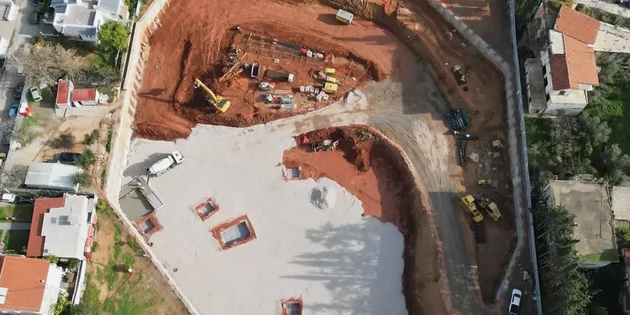
The excavator bucket hits gray silt, then a lens of cobbles, and three feet later the tone changes to a sharp ring against bedrock. That sequence is Juneau. The Gastineau Channel and surrounding valleys pack marine clay, glacial till, and weathered phyllite into a tight vertical column, and deep excavation here means programming the shoring to handle each transition without overbreak. Our team runs the drill rigs and reads the inclinometers ourselves because the test pits data that informs the upper ten feet often dictates whether a soldier pile wall or a tied-back system makes sense below. We log every change with ASTM D2487 field classification and cross-check it against the city’s high groundwater, which typically sits within six feet of grade in the downtown corridor.

In Juneau, the excavation support isn't just holding back dirt—it's managing a saturated glacial sequence that changes stiffness every three feet.

How we work

Juneau sits on a narrow strip between the Coast Range and the Inside Passage, receiving over 80 inches of precipitation annually. That water load keeps pore pressures elevated year-round, and combined with the 4.5-foot tidal range in Gastineau Channel, the effective stress in a 25-foot cut can swing noticeably between a morning low tide and an afternoon high. We incorporate CPT testing to map undrained shear strength in the soft silts and to pinpoint the depth where refusal signals the top of the weathered schist. Because much of the downtown area is built on estuarine deposits, we also run grain size analysis to confirm fines content before selecting a dewatering method—vacuum-assisted wells often outperform simple sump pumps when the silt fraction exceeds 40 percent.
Deep Excavation Design in Juneau Alaska: Managing Glacial Soils and Bedrock Transitions
Technical reference image — Juneau Alaska

Site-specific factors

The contrast between the Douglas Island side and the Lemon Creek valley illustrates the risk spread. Douglas sits on coarser glacial outwash with better drainage; a 20-foot excavation there tends to behave predictably with standard dewatering. Lemon Creek, closer to the Mendenhall River, carries compressible organic silts and a perched water table that can drop the factor of safety on a cantilever wall by 15 to 20 percent within a single storm cycle. The real hazard isn’t the visible cut face—it’s the basal heave that develops when the bottom softens after three days of rain. We’ve seen tidy excavations turn into mud sumps because the contractor didn’t expect the silt to lose structure that fast. Monitoring with real-time piezometers and daily survey checks catches the movement before it becomes a collapse, and that protocol is baked into every Juneau project we touch, no exceptions.

Need a geotechnical assessment?

Reply within 24h.

Email: info@geotechnicalengineering.sbs

Technical data

ParameterTypical value
Typical excavation depth in downtown Juneau15 to 35 ft below street grade
Predominant soil profileMarine silt and clay over glacial till, underlain by phyllite/schist bedrock
Groundwater depth (downtown)3 to 8 ft below surface, tidally influenced
Annual precipitation80+ inches (Juneau International Airport average)
Design standard for lateral earth pressureASCE 7-22 and IBC 2021 with site-specific geotechnical parameters
Common shoring systemsSoldier piles with timber lagging, tied-back secant walls, soil nail walls in till
Instrumentation frequency during excavationDaily inclinometer and piezometer readings during active cut stages

Associated technical services

01

Shoring Design and Peer Review

We develop soldier pile, secant, and soil nail wall designs with stage-excavation sequencing. Each design includes groundwater control measures keyed to the tidal range and precipitation patterns of the Gastineau Channel area.

02

Construction-Phase Instrumentation and Monitoring

We install inclinometers, vibrating-wire piezometers, and survey targets before the first bucket breaks ground. Data is reduced daily and compared against predicted deflection envelopes; exceedance triggers a call to the site superintendent within the hour.

Relevant standards

ASCE 7-22 Minimum Design Loads for Buildings and Other Structures, IBC 2021 (International Building Code) Chapter 18 Soils and Foundations, ASTM D1586 Standard Test Method for Standard Penetration Test, ASTM D2487 Standard Practice for Classification of Soils for Engineering Purposes (Unified Soil Classification System), OSHA 29 CFR 1926 Subpart P Excavations

Quick answers

What is the typical cost range for a geotechnical excavation design in Juneau?

For a commercial or municipal project with cuts between 15 and 35 feet, the design package generally falls between US$1,830 and US$7,200, depending on the shoring complexity, number of instrumentation points, and whether dewatering design is included. A downtown site with tide-influenced groundwater will sit at the higher end because it requires tighter stage sequencing and more piezometer channels.

How does the high rainfall in Juneau affect deep excavation stability?

The 80-plus inches of annual precipitation keep the vadose zone thin and pore pressures high. When a cut exposes silty soil, the matric suction that normally adds apparent cohesion disappears fast. We design for fully saturated conditions from day one and specify dewatering systems that can handle sustained inflow—often vacuum-assisted wellpoints rather than open pumping.

What shoring system works best when bedrock is shallow and irregular?

Soldier piles drilled into a weathered rock socket work well up to about 30 feet. For deeper cuts where the bedrock surface dips unpredictably, we lean toward tied-back secant walls because the continuous wall can span soft pockets without losing arching. The tieback bond length is designed specifically for the phyllite/schist common under downtown Juneau.

Do you handle the instrumentation and monitoring during construction?

We do. Our team places inclinometer casings, vibrating-wire piezometers, and optical survey prisms, then reads them daily during active excavation. The data goes into a live deflection-versus-depth plot that gets checked against the design envelope; if movement exceeds 80 percent of the allowable, we notify the contractor and engineer of record immediately.

Location and service area

We serve projects in Juneau Alaska and surrounding areas. More info.

View larger map